blah blah blah
Goodrich Rock
Length: 4.0 miles out-and-backDifficulty (click for info): Moderate
Elevation Gain: 700 feet
Rating (click for info): 6/10
Elevation: 2325'
Prominence (Height of rock): 20'
Driving Directions:
Trailhead and parking area are West Branch Road in Waterville Valley, NH. From Exit 28 on Rt. 93, drive 10.2 miles northeast and turn left onto Tripoli Road (signs for Waterville Valley Ski Area). In 1.2 miles, bear right to avoid the ski area entrance and continue 0.6 miles down Tripoli Road. Turn right onto West Branch Road, cross a bridge, and immediately bear left into the parking area. Click here for a Google map.
About the Hike:
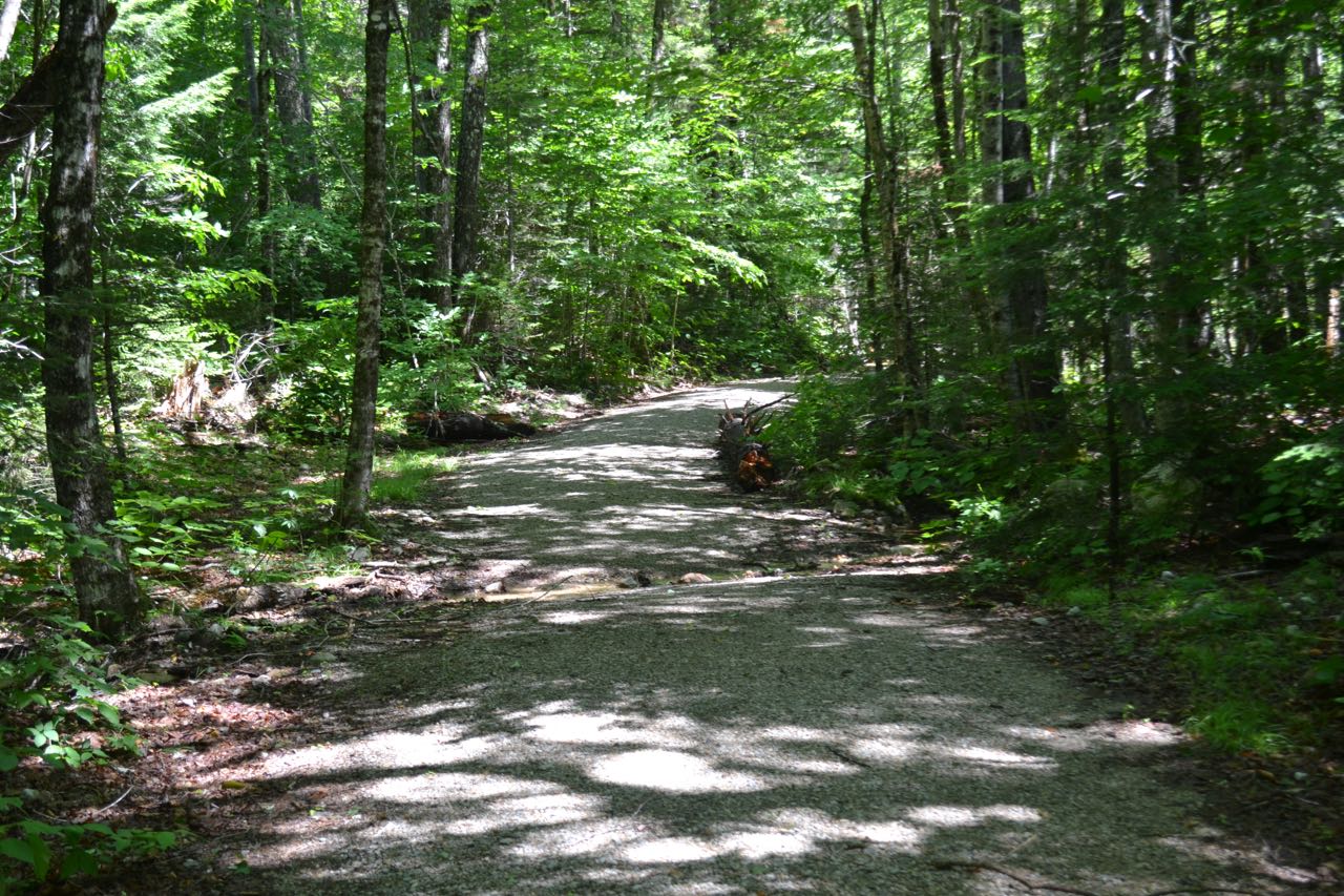
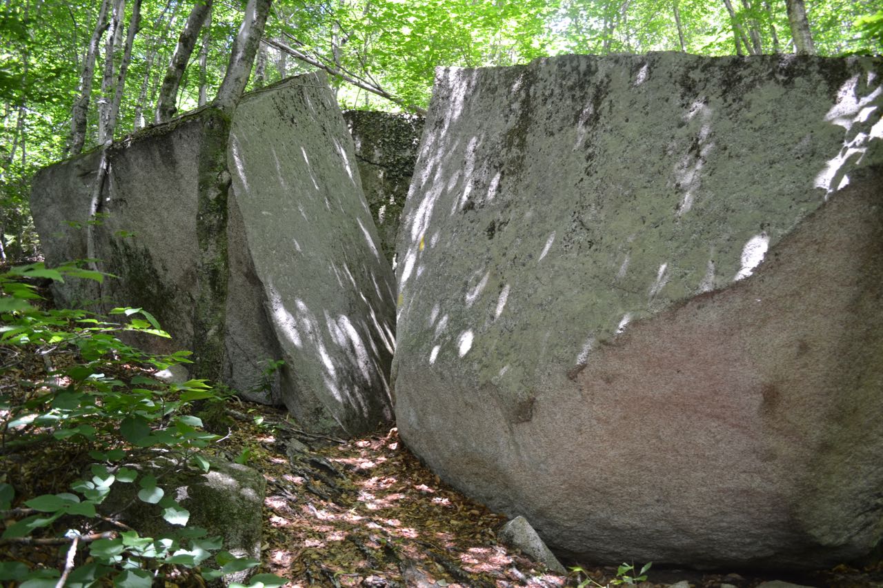
Goodrich Rock is an immense boulder on the lower slopes of East Osceola. A ladder provides access to the top of the rock and its view of Waterville Valley. On the way, you'll experience the fun of the impressive Davis Boulders as you walk around - and through - them. The hike begins with a pleasant stroll along the multi-use Livermore and Greeley Ponds Trails. Start from the kiosk at the east end of the parking area and walk out to a junction. Turn left onto the flat, graded Livermore Trail, marked as Livermore Road on the cross-country ski trail signs. An easy walk of 0.3 miles leads out to a grassy clearing. Descend to pass another multi-use trail and cross a brook on a bridge, then turn left onto Greeley Ponds Trail. Enjoy 0.9 miles on this wide gravel path, then turn left onto Goodrich Rock Trail. This trail immediately begins to climb, angling up a hillside past one small boulder. It ascends moderately for a while, then flattens out and heads across the slope. It dips to cross a little brook, ascends steeply up the other side, then resumes climbing at an easy grade.
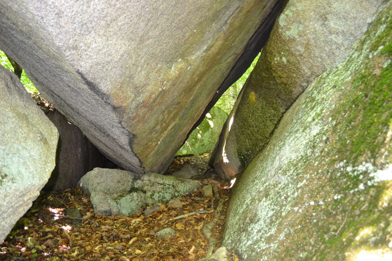
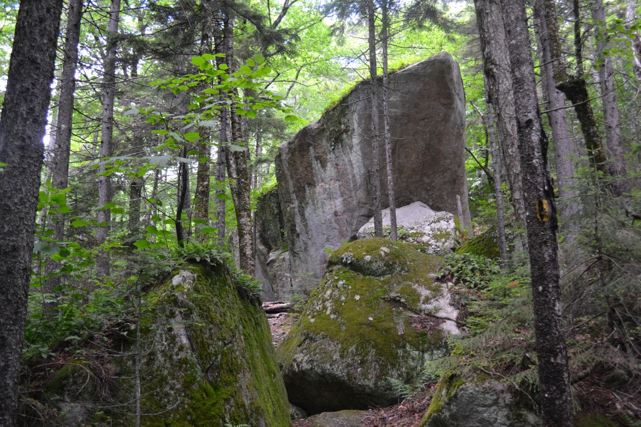
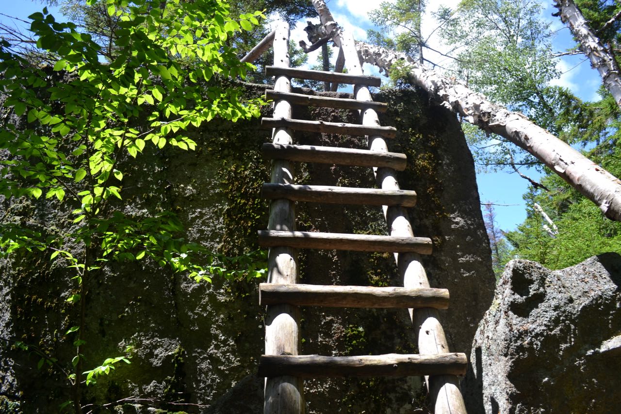
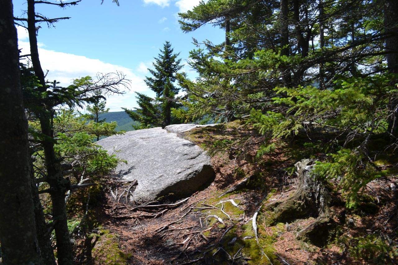
At 0.5 miles from Greeley Ponds Trail, reach the first of the Davis Boulders. This giant rock appears alone in the forest, but more, larger rocks lie ahead. The trail passes a tiny spring in a rock crevice, and soon reaches a large split boulder. It proceeds between the halves, taking a sharp left turn inside. Further up, the trail swings around an overhanging boulder, then passes between it and a smaller rock. Next, the trail splits, with one fork going through a tight boulder cave and one fork bypassing it. It then approaches a massive boulder shaped like the hull of a ship, turns left, and leaves the Davis Boulders area. The trail again travels across the hillside, eventually reaching a rough section with one rock scramble before descending to the base of the largest boulder of them all - Goodrich Rock. After passing a triangular cutout in the rock, the trail turns and climbs steeply uphill to the other side of Goodrich Rock. Around one last corner, a wooden ladder leads to the top, where it passes through a small stand of trees growing from the rock and ends, 0.3 miles from the first boulder. From here, there is a good view across Waterville Valley to Sandwich Dome. To the left is Flat Mountain, while to the right is Mt. Tecumseh and its ski area.
Printable directions page